
Kaneohe Bay on Oahu, Hawaii is a shallow bay protected from the open
ocean to the east by a barrier coral reef.
It is protected
by hills and mountains relatively close to the shore line.
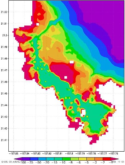
The Princeton Ocean Model (POM) is set up to model the circulation in Kaneohe Bay. The model domain is about 10 km by 13 km and the horizontal resolution is 120 m. There are 11 vertical levels that follows the bottom topography. The depth in the model range from 1 m to 100 m:
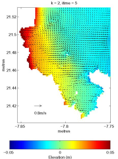
Sea surface elevation and surface currents after 1 day of forcing with a 20 m/s easterly trade wind (circulation model only):
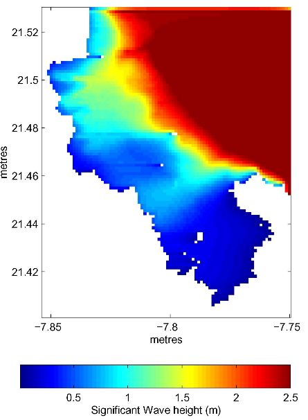
Significant wave height from the Mellor and Donelan (2006) wave model when forced by wind (10 m/s) and 10 s period incoming swell with 3 m wave height along the eastern boundary. The grid and bathymetry is the same as for the circulation model. The two models are now fully coupled so wave-current interaction and vertical varying wave radiation stresses are included in the model solutions.

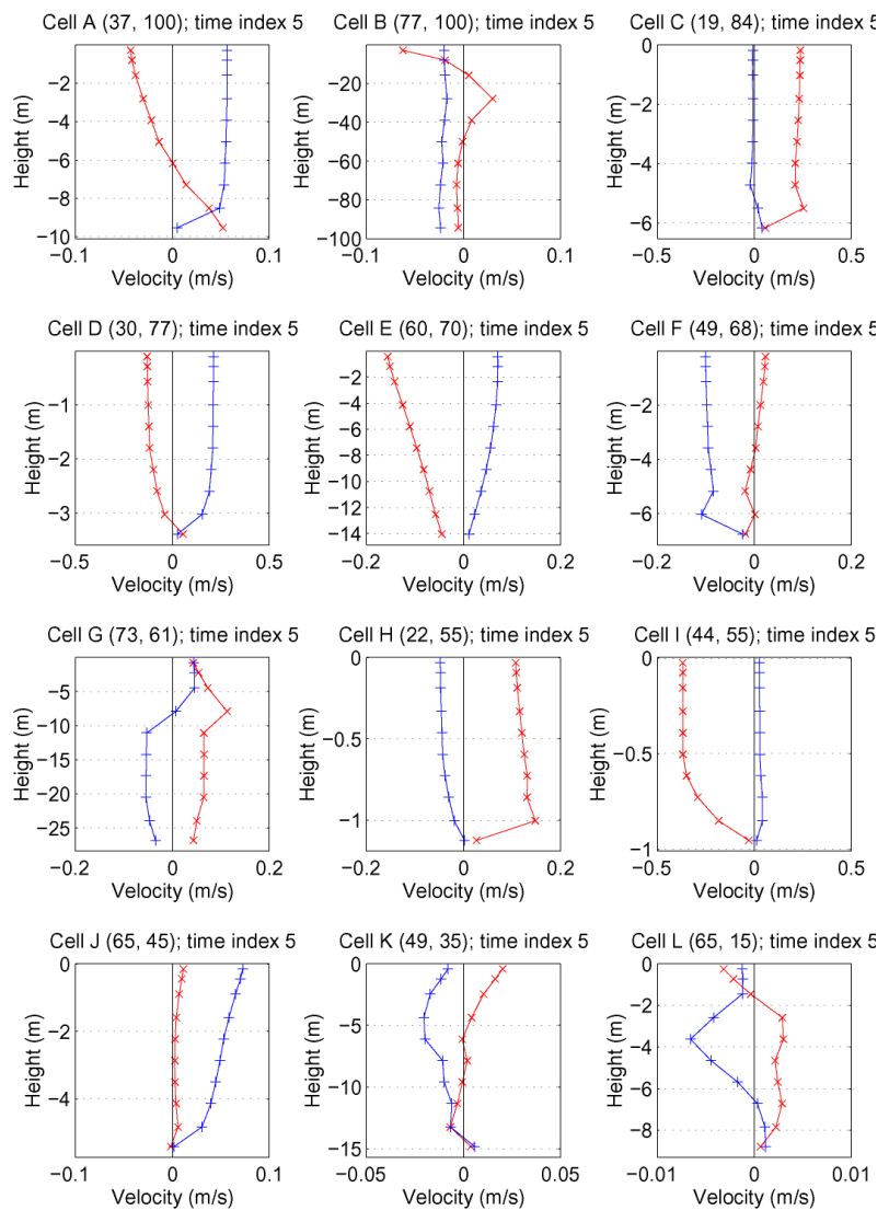
Note the strong onshore currents generated over the sandbar in the central bay, and outflow in the deeper channels to the north and to south. The currents vary with depth as shown at selected locations on the map below.
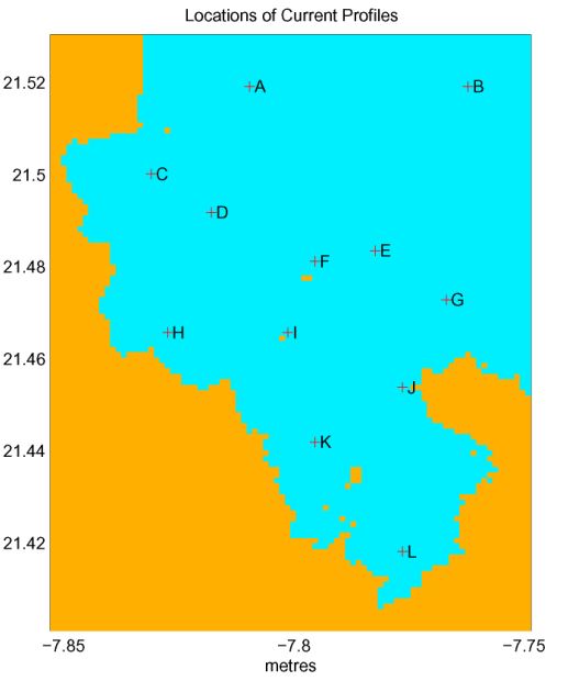
Profiles of current velocity components are shown below. The eastward component is shown in read and the northward component is shown in blue.
These results are preliminary. The model is still under development and the open boundary conditions are not yet realistic.
This research is funded by NOAA's PRIDE program.
 Home
Home
Tommy G. Jensen
tjensen@hawaii.edu
Last update: April 11, 2007