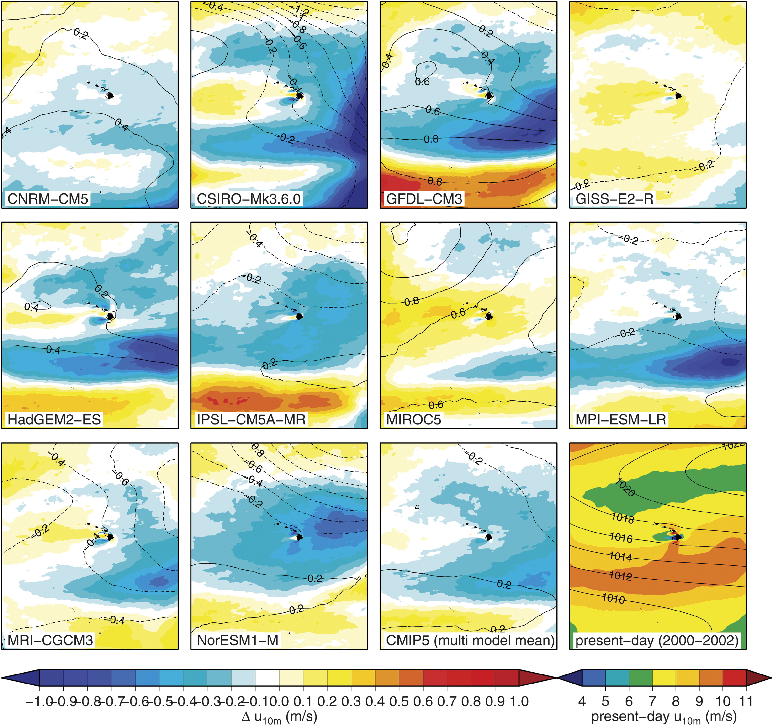
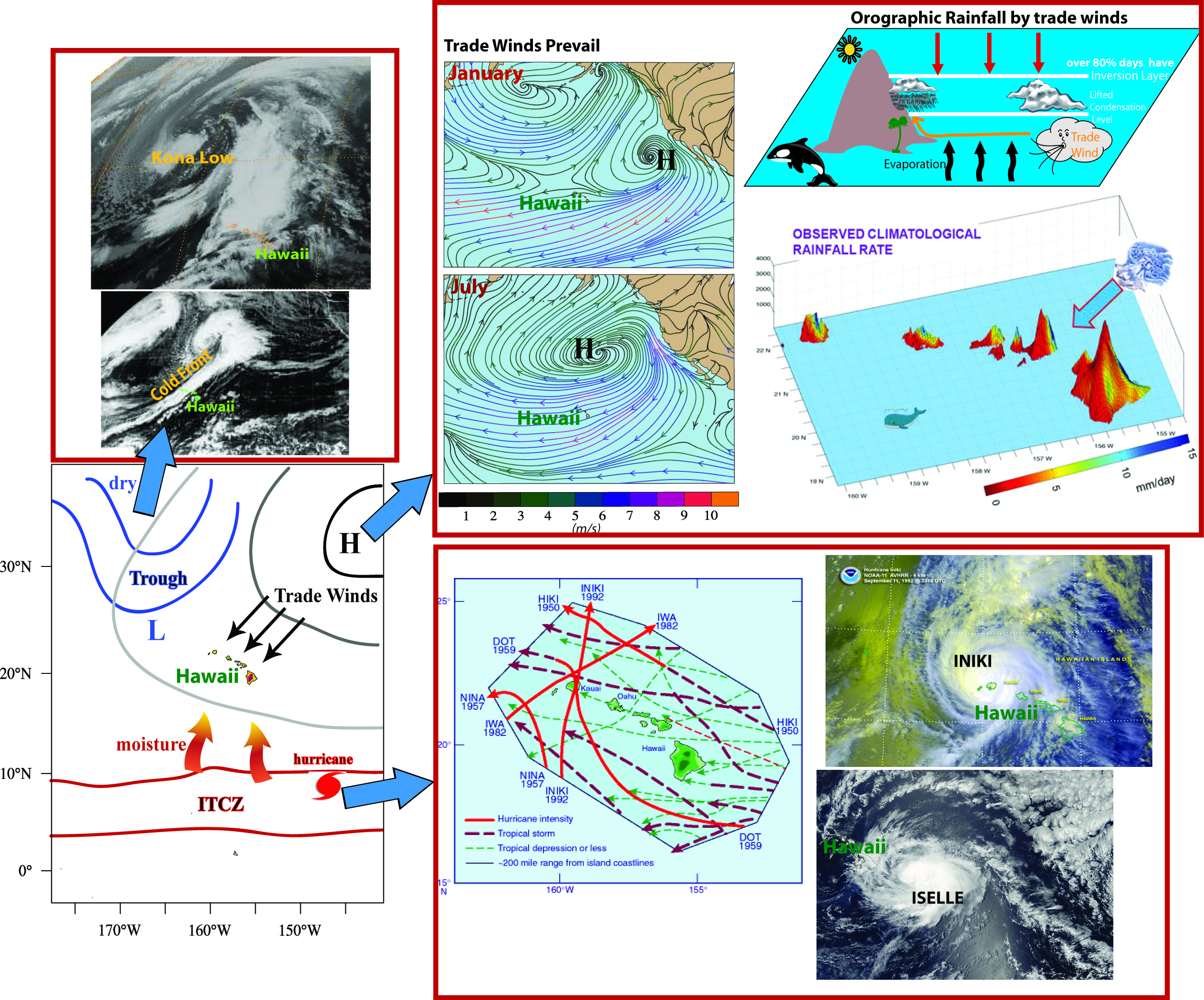
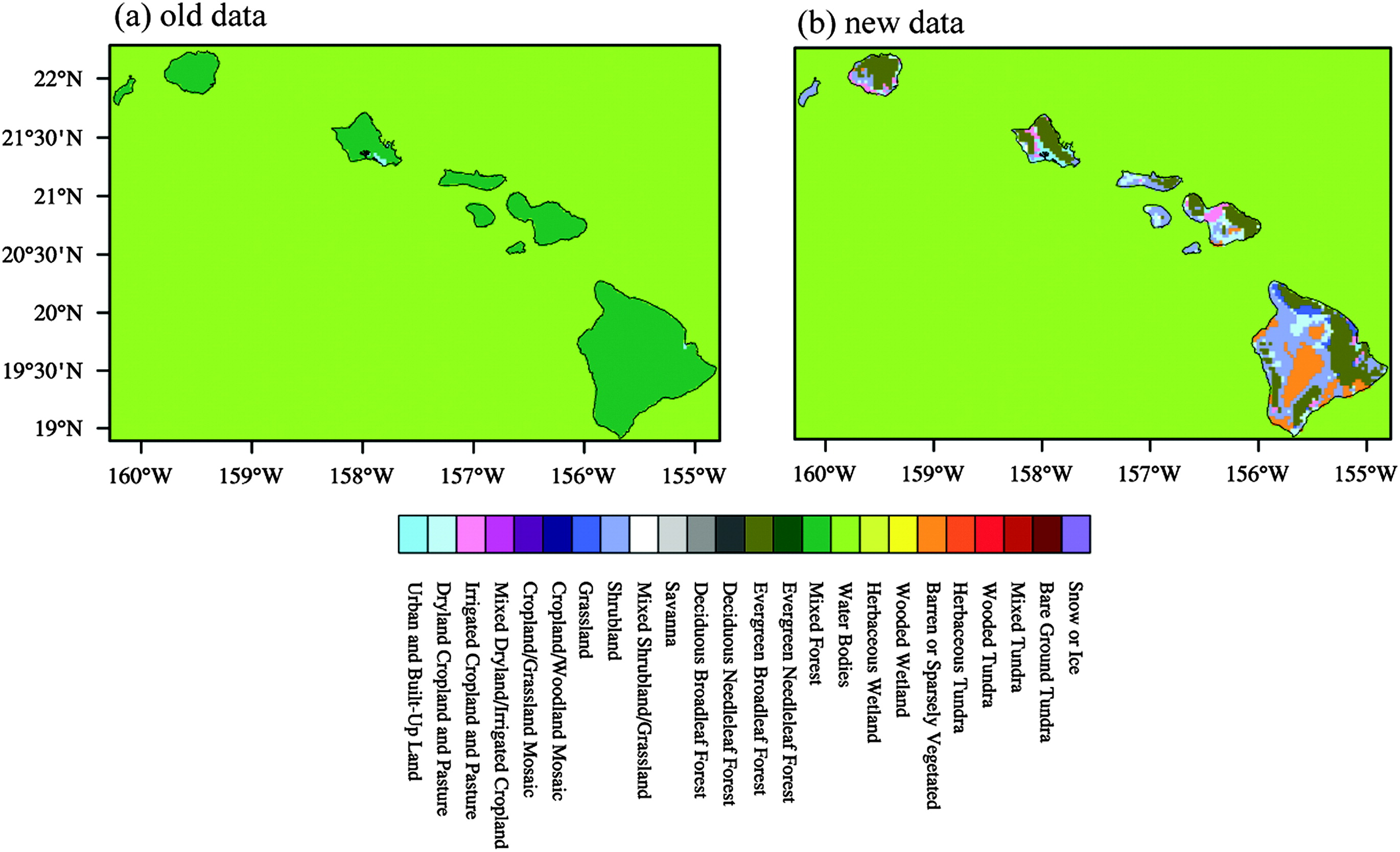
(1) Why downscaling?

Funded Projects
Climate Adaptation Partnership for the Pacific, subsward from the East-West Center
on a project funded by National Ocean and Atmosphere Administration (NOAA) Regional
Integrated Sciences and Assessments (RISA) Program (Sep 2010 - Aug 2015).
Published Papers
Zhang, C., Y. Wang, and K. Hamilton, 2011: Improved representation of boundary
layer clouds over the Southeast Pacific in WRF-ARW using a modified Tiedtke
cumulus parameterization scheme. Mon. Wea. Rev., 139, 3489-3513, doi:
10.1175/MWR-D-10-05091.1.
Zhang, C., Y. Wang, A. Lauer, and K. Hamilton, 2012: Configuration and Evaluation
of the WRF Model for the Study of Hawaiian Regional Climate. Mon. Wea. Rev.,
140, 3259-3277, doi: 10.1175/MWR-D-11-00260.1.
Lauer, A., C. Zhang, O. Elison Timm, Y. Wang, and K. Hamilton, 2013: Downscaling
of climate change in the Hawaii region using CMIP5 results: On the choice of the
forcing fields. J. Climate, 26 (24), 10006-10030,doi:10.1175/JCLI-D-13-00126.1.
Zhang, C., Y. Wang, K. Hamilton, and A. Lauer, 2016a: Dynamical downscaling of the
climate for the Hawaiian Islands. Part I: Present Day. J. Climate, 29, 3027-3048,
doi: 10.11175/JCLI-D-15-0432.1.
Zhang, C., Y. Wang, K. Hamilton, and A. Lauer, 2016b: Dynamical downscaling of the
climate for the Hawaiian Islands. Part II: Projection for the late 21st Century.
J. Climate. (In revision)

Cloud Water Interception in Hawaii: Building Spatial Pattern Maps for the Present-day Climate and Projected Changes by the Late 21st Century using the Hawaii Regional Climate Model, Funded by U.S. Geological Survey (USGS) (Oct 2015 - Sep 2017).
Very fine Resolution Dynamical Downscaling of Past and Future Climate for Assessment of Climate Change Impacts on the Islands of Oahu and Kauai, funded by U.S. Geological Survey (USGS) (Sep 2013 - Aug 2015).
(1) Clouds
Zhang, C., Y. Wang, A. Lauer, K. Hamilton, and F. Xie, 2012: Cloud base and top heights in the Hawaiian region determined with satellite and ground-based measurements. Geophys. Res. Lett., 39, L15706, doi:10.1029/2012GL052355.
Zhang, C., K. Hamilton and Y. Wang, Monitoring and projecting trends of Hawaii snow cover.
Future change
21st Century High-resolution Climate Projections for Guam and American Samoa, funded by U.S. Geological Survey (USGS) (Sep 2012 - Sep 2015)
Papers in preparation
Zhang, C., and Y. Wang, Projected future changes of tropical cyclone activity over the western North and South Pacific in a 20-km-mesh regional climate model.
(1) Modified Tiedtke Scheme - Since WRFV3.3
Zhang, C., Y. Wang, and K. Hamilton, 2011: Improved representation of boundary layer clouds over the Southeast Pacific in WRF-ARW using a modified Tiedtke cumulus parameterization scheme. Mon. Wea. Rev., 139, 3489-3513, doi: 10.1175/MWR-D-10-05091.1.
The scheme is tested in both IPRC Reginal Tropical Channel Model (iRegTCM) and WRF-ARW. The figure show the observed and simulated diurnal rainfall.


